
𝗝𝗢𝗜𝗡 𝗢𝗨𝗥 𝗪𝗛𝗔𝗧𝗦𝗔𝗣𝗣 𝗖𝗛𝗔𝗡𝗡𝗘𝗟! 𝗖𝗟𝗜𝗖𝗞 𝗢𝗡 𝗧𝗛𝗘 𝗟𝗜𝗡𝗞: https://whatsapp.com/channel/0029VaN7nmQGOj9na4QhBa12

Tropical Weather Outlook
NWS National Hurricane Center, Miami, FL
800 PM EDT Sun Oct 18 2026

For the North Atlantic…Caribbean Sea and the Gulf of America:
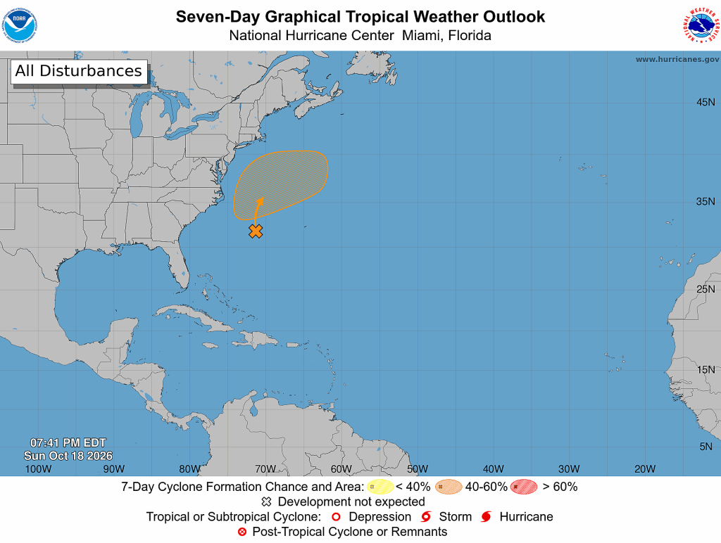
Off the East Coast of the United States:
A storm-force non-tropical low pressure area is developing along a frontal boundary tonight off the southeast coast of the United States. This low is likely to move slowly and erratically over the next couple of days while it initially remains non-tropical.
Later this week, if the system stays over the Gulf Stream, environmental conditions could become more conducive for the low to develop some subtropical characteristics.
A subtropical cyclone could form over the second half of this week as the system begins moving generally northeastward, offshore of the eastern United States.

Regardless of development, this system will cause high winds, coastal flooding, and dangerous surf along portions of the U.S. East Coast.
- Formation chance through 48 hours…low…near 0 percent.
- Formation chance through 7 days…medium…40 percent.






Leave a Reply