

𝗝𝗢𝗜𝗡 𝗢𝗨𝗥 𝗪𝗛𝗔𝗧𝗦𝗔𝗣𝗣 𝗖𝗛𝗔𝗡𝗡𝗘𝗟! 𝗖𝗟𝗜𝗖𝗞 𝗢𝗡 𝗧𝗛𝗘 𝗟𝗜𝗡𝗞: https://whatsapp.com/channel/0029VaN7nmQGOj9na4QhBa12

UPDATE:
…EDOUARD STRENGTHENING…
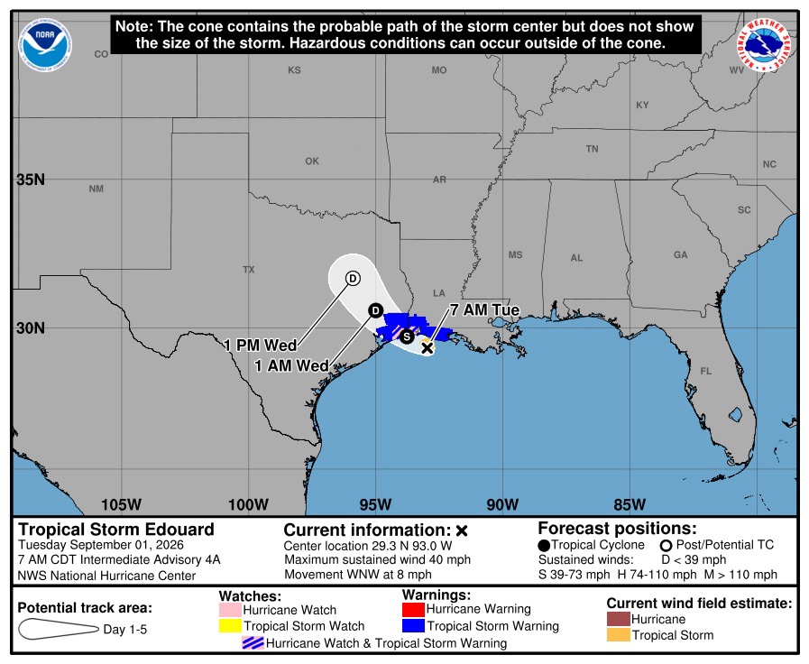
Air Force Reserve Hurricane Hunter aircraft data and WSR-88D radar data from Lake Charles, Louisiana, indicate that Edouard is now strengthening, and maximum sustained winds are up to 50 mph (85 km/h).

At 700 AM CDT (1200 UTC), the center of Tropical Storm Edouard was located near latitude 29.3 North, longitude 93.0 West. Edouard is moving toward the west-northwest near 8 mph (13 km/h).
A west-northwestward to northwestward motion is forecast during the next day or two. On the forecast track, the center of Edouard is forecast to reach the northwestern Gulf Coast within the warning area later today and move inland over southeast Texas tonight.

Maximum sustained winds are near 40 mph (65 km/h) with higher gusts. Significant strengthening is forecast today and Edouard could approach hurricane strength before it reaches the northwest Gulf coast later today. Rapid weakening is expected after the center moves inland.
Edouard is a small tropical cyclone. Tropical-storm-force winds
extend outward up to 25 miles (35 km) from the center. The minimum central pressure based on aircraft data is 1003 mb
(29.62 inches).




 safety steps
Leave a comment