U.S. Geological Survey (USGS): On December 26, 2004, a historic earthquake shook the world.

As many were celebrating the holiday season, a team of USGS scientists worked through the night, observing one of the largest and deadliest seismic events in modern history: the 2004 Sumatra-Andaman earthquake (Magnitude 9.1).

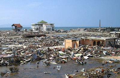
This catastrophic event triggered tsunamis that claimed over 230,000 lives across Indonesia, Sri Lanka, India, and Thailand.

But from tragedy came transformation. The aftermath led to groundbreaking changes in how we monitor earthquakes and protect lives:

• Enhanced magnitude calculation methods
• Improved international data sharing
• 24/7 monitoring capabilities
• Better tsunami warning systems

This wasn’t just a response—it was a revolution in global earthquake monitoring. Science is not just about data, it’s about understanding, responding, and saving lives.
Cover image credit: National Oceanic and Atmospheric Administration (NOAA) – Tsunami aftermath in Banda Aceh, Indonesia, where only a few structures remained standing. Source: Hokkaido University, Yuichi Nishimura


Leave a comment