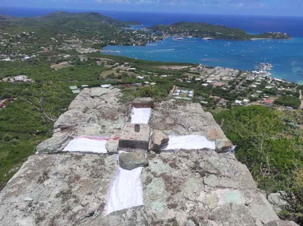
Antigua and Barbuda National Park – Caution to residents, hikers and other adventure seekers; These markers serve an important purpose in facilitating LIDAR surveys.

LIDAR, which stands for Light Detection and Ranging, is a remote sensing technology used to measure distances and create detailed maps of the terrain.
The markers have been strategically positioned to aid in the accurate collection of data during the surveys.

They play a vital role in ensuring the precision and reliability of the information gathered. Therefore, we urge persons to refrain from removing or moving these markers.
Happy exploring in the park and thank you for your cooperation.


Leave a comment