
𝗝𝗢𝗜𝗡 𝗢𝗨𝗥 𝗪𝗛𝗔𝗧𝗦𝗔𝗣𝗣 𝗖𝗛𝗔𝗡𝗡𝗘𝗟! 𝗖𝗟𝗜𝗖𝗞 𝗢𝗡 𝗧𝗛𝗘 𝗟𝗜𝗡𝗞: https://whatsapp.com/channel/0029VaN7nmQGOj9na4QhBa12

For the North Atlantic… Caribbean Sea and the Gulf of America:
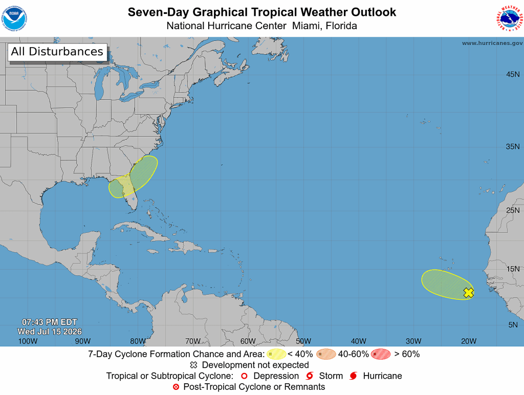
- Eastern Tropical Atlantic:
Showers and thunderstorms associated with a tropical wave located southeast of the Cabo Verde Islands have become slightly better organized since yesterday. Some additional slow development is possible during the next couple of days while the system moves generally west-northwestward at about 10 mph. By this weekend, the system is forecast to move into a less conducive environment, and further development is not expected.
- Formation chance through 48 hours…low…10 percent.
- Formation chance through 7 days…low…10 percent.
- Northeastern Gulf of America and Offshore of the Southeastern U.S.:
An area of low pressure is forecast to form during the weekend over the northeastern Gulf of America. Some gradual development of this system is possible while it moves slowly northeastward over the northeastern Gulf of America and near the coast of the southeastern United States early next week.
- Formation chance through 48 hours…low…near 0 percent.
- Formation chance through 7 days…low…20 percent.




 safety steps
Leave a comment