
𝗝𝗢𝗜𝗡 𝗢𝗨𝗥 𝗪𝗛𝗔𝗧𝗦𝗔𝗣𝗣 𝗖𝗛𝗔𝗡𝗡𝗘𝗟! 𝗖𝗟𝗜𝗖𝗞 𝗢𝗡 𝗧𝗛𝗘 𝗟𝗜𝗡𝗞: https://whatsapp.com/channel/0029VaN7nmQGOj9na4QhBa12

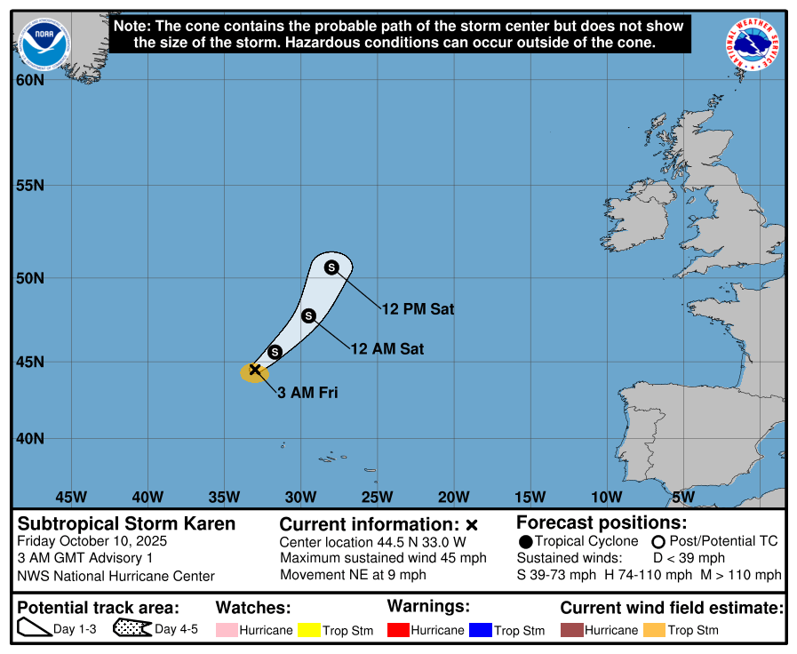
At 300 AM GMT (0300 UTC), the center of Subtropical Storm Karen was located near latitude 44.5 North, longitude 33.0 West. The storm is moving toward the northeast near 9 mph (15 km/h).
This motion with some gradual acceleration is forecast over the next day or two. Maximum sustained winds are near 45 mph (75 km/h) with higher gusts.

Little change in strength is forecast during the next day or so,
and the system should open up into a trough by this weekend.
Winds of 40 mph extend outward up to 60 miles (95 km) from the center. The estimated minimum central pressure is 998 mb (29.47 inches).





Leave a Reply