
VOTE! VOTE! VOTE! Vote for the founder and director of S.T.E.P.S. Click on the link: https://docs.google.com/…/1FAIpQLSeG81HScO…/viewform

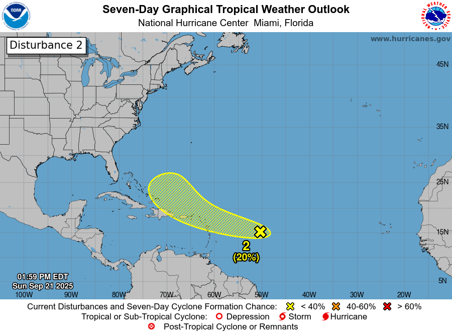
Tropical Weather Outlook
NWS National Hurricane Center Miami FL
200 PM EDT Sun Sep 21 2025
For the North Atlantic…Caribbean Sea and the Gulf of America:

East of the Windward Islands:
Another tropical wave located more than 500 miles to the east of the Windward Islands is currently is producing a small area of
disorganized showers and thunderstorms as it moves quickly westward.

Earlier satellite-derived wind data indicated the wave does not have a closed circulation. Environmental conditions appear only
marginally conducive for further development over the next several days as the wave continues to move quickly westward to west-northwestward at around 20 mph.

By the latter part of this week, the system is expected to slow down and turn more northwestward to the north of Hispaniola. Regardless of development, the system is expected to bring gusty winds and showers for portions of the Leeward Islands on Tuesday.

- Formation chance through 48 hours…low…10 percent.
- Formation chance through 7 days…low…20 percent.


Leave a comment