
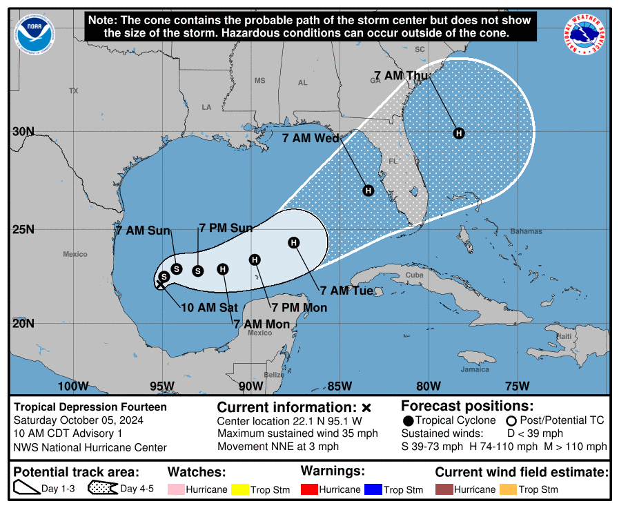
At 1000 AM CDT (1500 UTC), the center of Tropical Depression
Fourteen was located near latitude 22.1 North, longitude 95.1 West.

The depression is moving toward the north-northeast near 3 mph (6km/h). A slow northeastward or east-northeastward motion is expected during the next day or so. A faster east-northeastward to northeastward motion is forecast by Monday and Tuesday.

On the forecast track, the depression is forecast to remain over the southwestern Gulf of Mexico through Sunday night, then move across the south-central Gulf of Mexico on Monday and Tuesday, and approach the west coast of the Florida Peninsula by midweek.

Maximum sustained winds are near 35 mph (55 km/h) with higher gusts. Rapid strengthening is forecast during the next few days. The depression is forecast to become a tropical storm later today and a hurricane by early Monday.

The system could become a major hurricane while it moves across the central and eastern Gulf of Mexico. The estimated minimum central pressure is 1007 mb (29.74 inches).


Leave a comment