
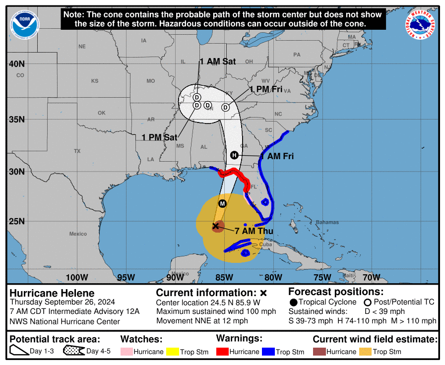
At 700 AM CDT (1200 UTC), the center of Hurricane Helene was located near latitude 24.5 North, longitude 85.9 West.
Helene is moving toward the north-northeast near 12 mph (19 km/h). This general motion is expected to continued with a significant increase in forward speed during the next 24 hours.

On the forecast track, Helene will move across the eastern Gulf of Mexico today and cross the Florida Big Bend coast this evening or early Friday morning.
After landfall, Helene is expected to turn northwestward and slow down over the Tennessee Valley on Friday and Saturday.

Maximum sustained winds have increased to near 100 mph (155 km/h) with higher gusts.
Additional strengthening is forecast, and Helene is expected to be a major hurricane when it reaches the Florida Big Bend coast this evening.

Weakening is expected after landfall, but Helene’s fast forward speed will allow strong, damaging winds, especially in gusts, to penetrate well inland across the southeastern United States, including over the higher terrain of the southern Appalachians.
Hurricane-force winds extend outward up to 60 miles (95 km) from the center and tropical-storm-force winds extend outward up to 345 miles (555 km).

The Key West Naval Air Station recently reported sustained winds of 41 mph (66 km/h) and a wind gust of 55 mph (89 km/h). An observation in Sand Key recently reported sustained winds of 45 mph (72 km/h) and a gust to 58 mph (93 km/h).
The estimated minimum central pressure based on data from the NOAA and Air Force Reserve Hurricane Hunter aircraft is 960 mb (28.35 inches).


Leave a comment