
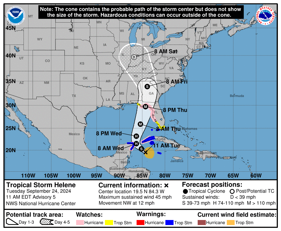
At 1100 AM EDT (1500 UTC), the center of Tropical Storm Helene was located near latitude 19.5 North, longitude 84.3 West. Helene is moving toward the northwest near 12 mph (19 km/h), and this general motion is expected to continue through early Wednesday.

A northward to north-northeastward motion at a faster forward speed is expected on Wednesday and Thursday. On the forecast track, the center of Helene will move across the far northwestern Caribbean Sea through tonight, and then move across the eastern Gulf of Mexico Wednesday and Thursday, potentially reaching the Gulf coast of Florida late Thursday.

Data from an Air Force Reserve Hurricane Hunter aircraft indicate that the system has acquired a well-defined center of circulation, and maximum sustained winds have increased to near 45 mph (75 km/h) with higher gusts. Additional strengthening is forecast, and Helene is expected to become a hurricane on Wednesday.

Continued strengthening is anticipated after that time, and Helene could become a major hurricane on Thursday.
Tropical-storm-force winds extend outward up to 140 miles (220 km) to the east of the center. Data from the Hurricane Hunter aircraft indicate that the minimum central pressure is 1000 mb (29.53 inches).


Leave a comment