
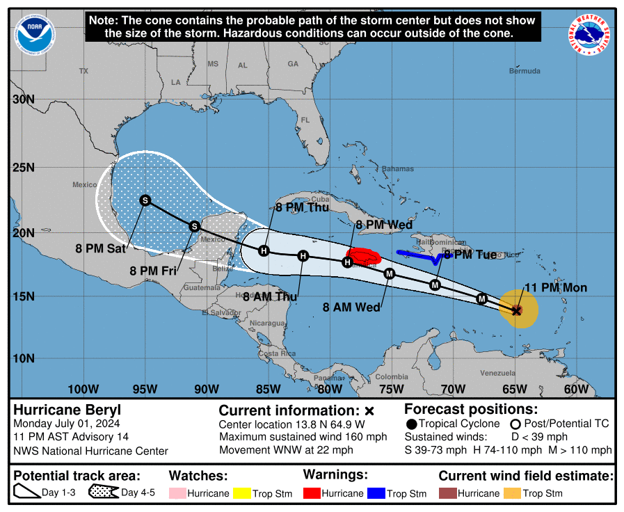
At 1100 PM AST (0300 UTC), the center of Hurricane Beryl was located near latitude 13.8 North, longitude 64.9 West. Beryl is moving toward the west-northwest near 22 mph (35 km/h). Beryl is forecast to continue moving rapidly west-northwestward during the next couple of days.

On the forecast track, the center of Beryl will move quickly across the southeastern and central Caribbean Sea tonight through Tuesday and is forecast to pass near Jamaica on Wednesday.
Recent data from the NOAA Hurricane Hunters indicates that the maximum sustained winds have increased to near 160 mph (260 km/h) with higher gusts. Beryl is now a potentially catastrophic category 5 hurricane on the Saffir-Simpson Hurricane Wind Scale.

Fluctuations in strength are likely during the next day or so, but Beryl is expected to still be near major hurricane intensity as its moves into the central Caribbean and passes near Jamaica on Wednesday.
Some more weakening is expected thereafter, though Beryl is forecast to remain a hurricane in the northwestern Caribbean.

Hurricane-force winds extend outward up to 40 miles (65 km) from the center and tropical-storm-force winds extend outward up to 125 miles (205 km).
The minimum central pressure recently measured by the NOAA
Hurricane Hunter dropsonde data is 938 mb (27.70 inches).


Leave a comment