
Very dangerous major hurricane Beryl still strengthening as it approaches the Windward Islands. Life-threatening winds and storm surge expected there beginning early Monday morning.

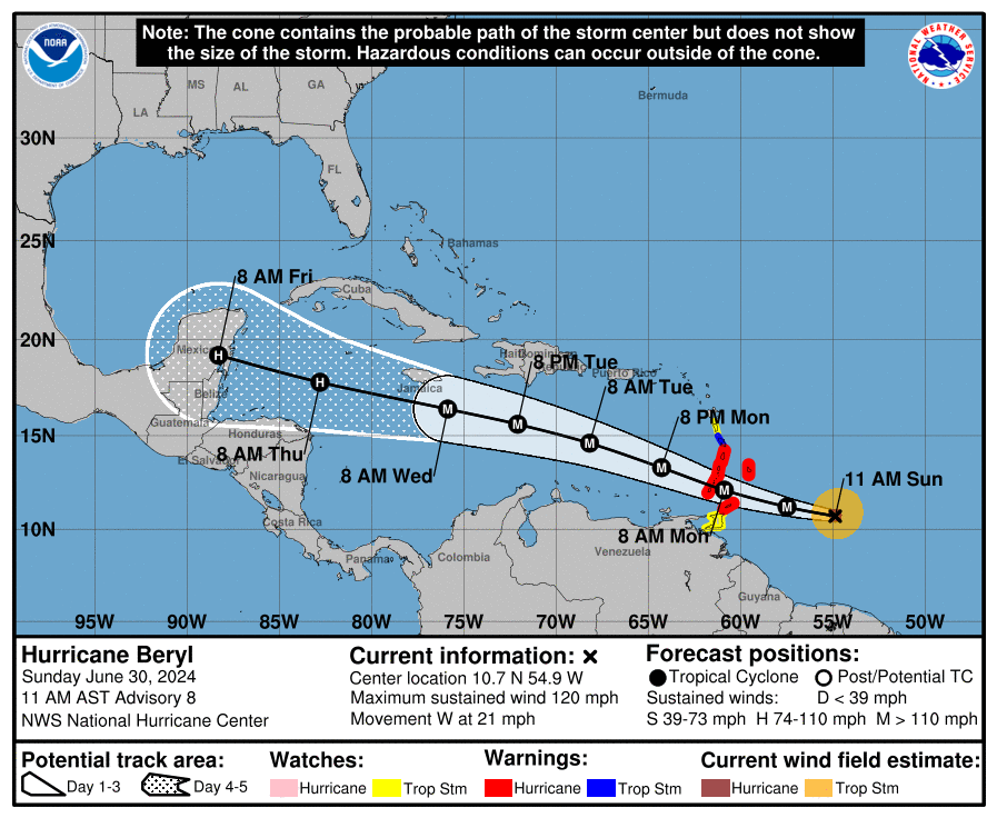
At 1100 AM AST (1500 UTC), the eye of Hurricane Beryl was located near latitude 10.7 North, longitude 54.9 West. Beryl is moving toward the west near 21 mph (33 km/h).
A continued quick westward to west-northwestward motion is expected during the next few days. On the forecast track, the center of Beryl is expected to move across the Windward Islands Monday morning and across the southeastern and central Caribbean Sea late Monday through Wednesday.

Maximum sustained winds have increased to near 120 mph (195 km/h) with higher gusts. Beryl is a category 3 hurricane on the Saffir-Simpson Hurricane Wind Scale.
Some additional strengthening is forecast through tonight, and Beryl is expected to become an extremely dangerous category 4 hurricane before it reaches the Windward Islands.

Hurricane-force winds extend outward up to 30 miles (45 km) from the center and tropical-storm-force winds extend outward up to 115 miles (185 km).
The minimum central pressure based on data from the NOAA and Air Force Hurricane Hunters is 964 mb (28.47 inches).


Leave a comment