
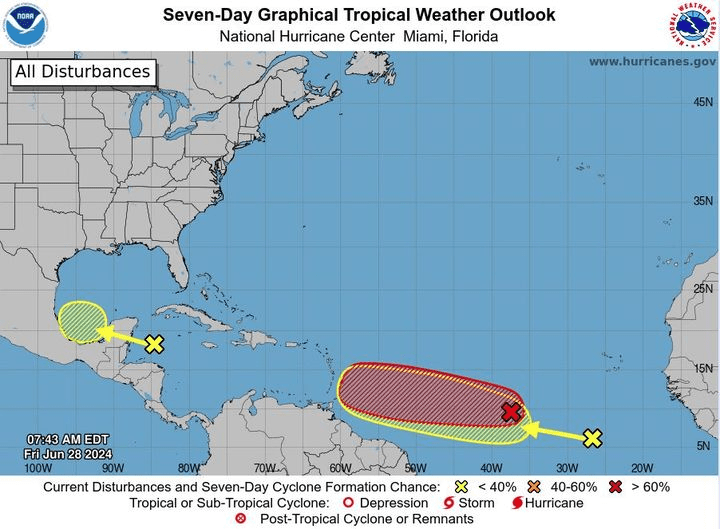
For the Caribbean Sea, the National Hurricane Center continues to monitor two areas of interest in the Atlantic;
In Tropical Central Atlantic (AL95): A low pressure system located about 1500 miles east-southeast of the Barlovento Islands is gradually becoming better defined.

Showers and thunderstorms are also showing signs of organization, and a tropical depression or tropical storm is likely to form later today or Saturday.

This system is expected to move west at 15 to 20 mph and approach the Lesser Antilles by the end of the weekend. Interests there should monitor the progress of this system.
The probability of formation is high with one (90 percent) in the next 48 hours and in the next 7 days.

Tropical Atlantic East: A tropical wave centered several hundred miles south-southeast of the Cape Verde Islands is producing disorganized downpours and thunderstorms.
Some slow development of this system is possible next week as it moves generally west across the central and western tropical Atlantic at 15 to 20 mph.

The probability of formation is near zero percent in the next 48 hours and a low probability (20 percent) in the next 7 days.


Leave a comment