
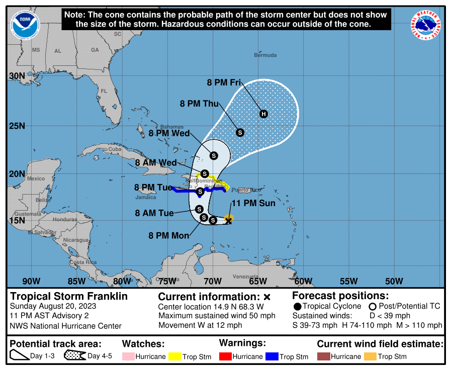
At 1100 PM AST (0300 UTC), the center of Tropical Storm Franklin was located near latitude 14.9 North, longitude 68.3 West. Franklin is moving toward the west near 12 mph (19 km/h).

A westward to west-northwestward track is expected to continue into Monday. A sharp turn to the north is expected Monday night and a northward motion is expected on Tuesday.
On the forecast track, the center of Franklin is forecast to reach the southern coast of Hispaniola late Tuesday or Tuesday night. Maximum sustained winds are near 50 mph (85 km/h) with higher gusts.

Some strengthening is forecast during the next 48 hours. Tropical-storm-force winds extend outward up to 60 miles (95 km) from the center. The estimated minimum central pressure is 999 mb (29.50 inches).
Franklin is expected to produce rainfall amounts of 2 to 4 inches, with isolated higher amounts of 6 inches, across Puerto Rico through the middle of the week. Rainfall amounts of 4 to 8 inches, with isolated higher amounts up to 12 inches, will be possible across portions of Hispaniola.

WIND: Tropical storm conditions are expected to begin within the warning area on Tuesday and are possible within the watch area beginning late Tuesday.
STORM SURGE: A storm surge will raise water levels by as much as 1 to 3 feet above ground level along the immediate coast near and to the east of where the center makes landfall in Hispaniola.
Forecaster Brown


Leave a comment